Nationals 2022 Recap

It’s been a month since Nationals, so I figure I better post this.

I’ve done laundry since I wrote this; Instagram had blocked me from posting it because it was too wordy.

My numbers are still pinned on my speedsuit, so I suppose it's not too late for a Nationals Road Race recap post. #ProcrastinationFTW #LaundryDayIsWhen?

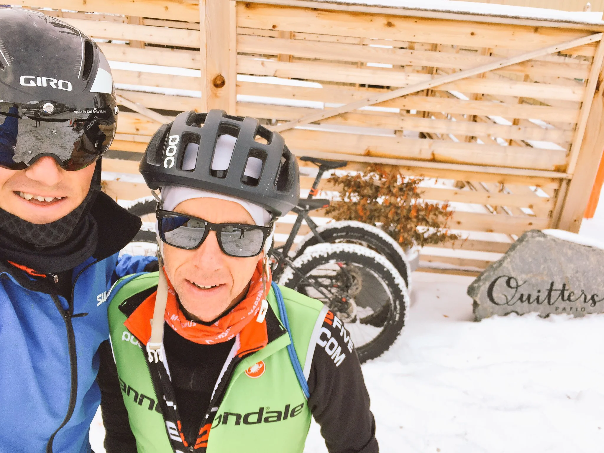
Like last year, Anthony joined me on the adventure. I'm grateful for his cool head, attention to detail, and his subtle ability to get my mindset in the right frame of mind. Ie. Asking twice which follow vehicle I wanted my wheels in: peleton or breakaway? My second answer was the right one, but Tony asking twice was the key.

To my surprise, Janine was excited to come on the trip to Victoriaville as well. Her support has been immense through the years, both on and off the bike, and for cycling and non-cycling things. It meant a lot that she wanted to be a part of one of the bigger days where I go off to play bike racing.

Her handling of logistics (car rental), hand-ups in the feed zone (after some instruction from Anthony) were super helpful, and her pre-race good luck kisses, smile, and laughs helped me to stay relaxed and enjoy the day. It was the first time Janine had handed me up bottles, and that is one of the highlight images that sticks in my head from the weekend.

All this helped me to focus on my prep and execution for the 132km road race. This year I had decided to skip the time trial, and go all in on the road race, as that is still my bucket list box to check.

It had been 10 years since I got second at the Nationals Road Race in Lac Megantic. And while I'm not so superstitious to expect anything special about an anniversary, it was a good reminder of how much that result (loss) spurred me to up my game and how far I have come since then.

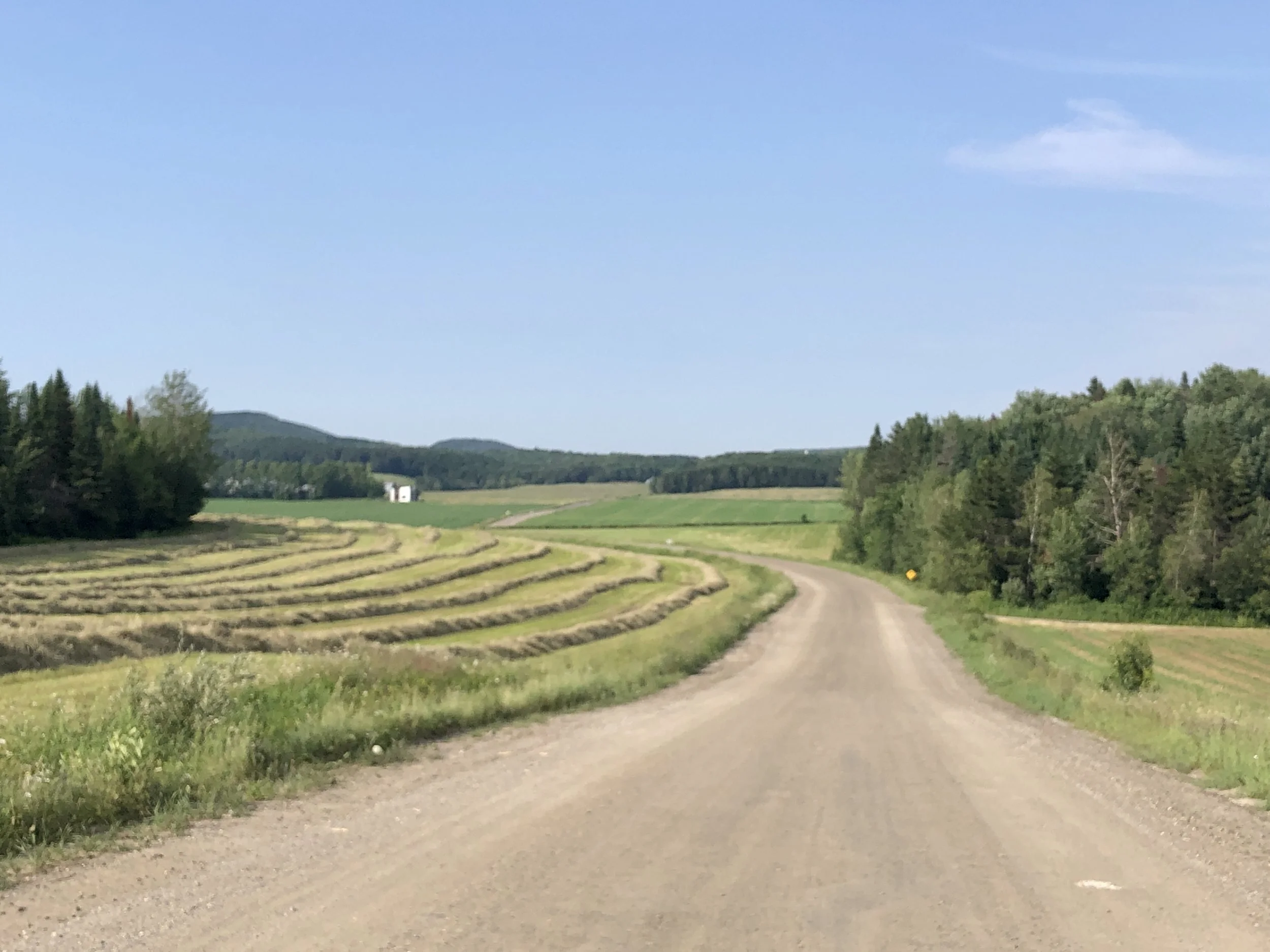
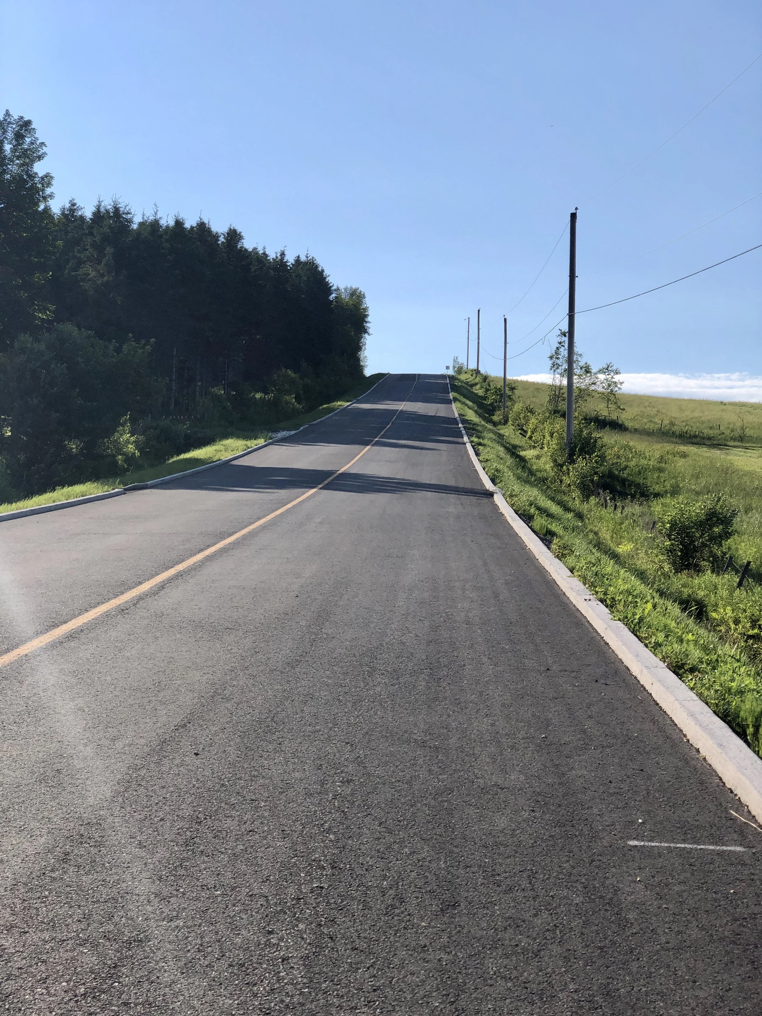
The race itself was set to be a marathon edition, with more climbing and more kilometers than the previous year. Pacing and fueling would be key, in addition to making the splits when they happened.

Both this year and last, the move went in the same place, again when Bruno forced a split on a hard grade out of a fast downhill corner. And both this year and last, I had put myself in the right place after moving up on the downhill to be in good position exiting the corner.

But this year, with better legs, there was no hesitation, and I closed the gap to the wheels in front. And just like, we were a breakaway of six, 45kms in, before even rolling through the first feed zone. At the time it felt like it was too easy, but of course, it would only get harder from here.

My breakaway companions and I collaborated well, quickly growing out our gap to over a minute. And by the beginning of the third circuit, the gap had grown to over 4 minutes. This seemed like a healthy margin over what I imagined would be a reduced peleton behind.

However, 95km into the race, and half-way around the circuit, my legs started to feel some cramp. I moved to the front of the group before a climb, hoping to control the pace. Out of the corner of my eye, I saw Bruno's final attack to leave us all behind. Off he went, and while the rest tried to chase him and each other, I had to ride a controlled pace to avoid leg cramps from taking over.

The optimistic part of me said perhaps I can recover and the others would falter on the 37km left back to the finish in town. The less optimistic part of me started getting concerned about holding off whatever remained of the group behind, all on my own.

Through the circuit feed zone climb one last time to get a bottle from J9, the descent off it let my legs recover a bit, and the chance of my legs completely seizing dissipated, as did my optimism for catching those ahead to compete for the medal positions.

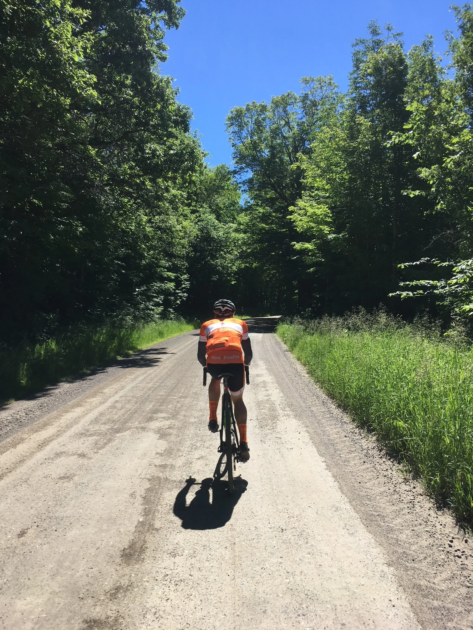
I settled into a rhythm I thought I could manage for the last 30km, attempted to avoid the bad lines in the two gravel sections, got 2 bottles in the bonus feed zone (Thx to Tony who had pedalled over there), and battled a nasty headwind for the last 5km to survive for 6th place.

I would have liked to have been in with a shot at the medals with the riders ahead, but in the end the legs decide, and it was an effort and a result I am happy with. As I said to Janine after: It could have gone a bit better; it could have gone a lot worse.

All in all, it was an awesome weekend, definitely a highlight reel for 2022. Between the recon-ride, race day, post-race patio time, and the day after route verte spin, it was a good times, and I'm so grateful to have had Anthony and Janine alongside for the ride.
#nine2fivepro

The Unintended Consequences of Gravel Riding: A Road Racers journey to Gormont

As someone who's heart was always in road racing I've gone through quite a transformation over the last year. Growing up I always had a road bike with skinny tires and gravel was to be avoided at all costs. After a few years of triathlon the swimming part finally caught up with me and it was back to road cycling. As a junior I made it onto the National Team for the Tour de L'Abitibi in 1995 and won the National Road Race title in 1996. It was pavement or bust. In the fall of 1997 I finally branched out and tried cyclocross and despite doing it on my regular road bike and being technically awful I enjoyed it alot. 

After a long hiatus I raced road again, then took another long break, then returned, then stopped. Last year I started training again for road racing with the intention of never stopping.  However the most prestigious event in Ottawa is the 30 year old gravel event Almonte-Roubaix and after finishing it last year it got me motivated to explore what else might be out there. I wasn't sure where it would lead and I figured I would have a bit of fun and then get back to the business of road racing. Turns out it led me down a path from which there was no return. Alot of unintended consequences arose from getting the gravel riding bug and I've found my mindset completely overturned and my perspective forever altered. 

The local scene is quite vibrant and I aspired to participate in all of it last year. I did the Gat Challenge, the OBC TT, the Airport Crits, the Cyclelogik A Ride, along with all the road races within a few hours drive and had alot of fun. Although I find Gatineau Park a little stale it's a unique place to ride and the Gat Challenge is a unique event. The OBC TT is a great event to compare yourself with others and challenge yourself to get a personal best. Although the busy traffic has held me up at the turn a few times it's a nice flat course, perfect for a 15km TT, so I braved traffic to attend despite spring rain and cold weather to start. I really enjoyed the atmosphere at the Airport Crits last year. I liked the course even more so I drove the 140km round trip through rush hour traffic to participate. I even begged my brother Charlie to come because it was a fast safe event. (He hates crits) The Cyclelogik ride was fun, fast and I saw some teammates each time but there's only so many times I can do the Carp Loop and dodge bomb craters on the terribly paved roads the rides uses. 

Things dramatically changed on November 14th last year when I made a 30min drive to Hopetown and did a short 18km loop. I had noticed some roads on google maps and curiosity always wins with me. The roads looked to be unmaintained so I planned a short loop thinking it would be slow going like the unmaintained roads I'd experienced in West Carleton or Almonte-Roubaix. The first road I took Stewart Gibson left me perplexed and spellbound. The sign said "unmaintained" but it was a single lane gravel road in such pristine condition I thought maybe I should go back and check the sign again. I turned right on Conc 2 and proceeded to the next road I wanted to check out, Lammermoor. To my surprise it was the exact same thing. I had budgeted a couple hours for the ride due to the difficulties I thought I would encounter but I was done in 50min. 

After a few more rides it became clear to me that well within an hour of my doorstep was a treasure trove of single lane farm roads in pristine condition that traversed scenery which kept my eyes busy the entire ride. Unfortunately I had noone to share it with which was a little disheartening but I was still extremely motivated to explore on my own. As winter approached I was pulling my balaclava up over my head in dwindling sunlight and getting directions from hunters up in the trees, so not wanting to get shot, freeze or run over in dusk I had to call curtains on my gravel exploring. 

I spent the winter formulating a gravel exploring plan of attack. I was training hard on Zwift but all I could really think about was what gravel roads I'd tackle next year. I went out in early spring to check some of the local unmaintained roads only to have to turn back due to snow cover. Same thing happened when I tried to recon some roads around Renfrew. Then when the season started I was doing so many races that I started to get annoyed that they were interfering with my gravel season.

Simultaneously I began communicating with a new nine2five recruit Alain Villeneuve. I had mentioned the idea of having a map of where all nine2fivepro members lived and about having a map showing where the gravel roads were and describing them using a legend and in a flash he set all of those things up. One thing led to another and our relationship snowballed into the Kinburn Kermesse, The West Carleton Gravel Series and my most enjoyable endeavor, Gormont (Alain came up with this term when we saw so many people driving 5hrs to Vermont to gravel ride). Since the first one on June 16th there's been 5 more plus a Vilmont (when I unexpectedly couldn't make a ride I had planned). Over this time I've lost all interest in doing any of the local training events (except the Kermesse of course) and I have absolutely no interest in participating in the local cyclocross series even though we're lucky to have such a series in Ottawa. After seeing what I've seen, endless kilometers of pristine single lane gravel roads, everything else seems non-existent. I'll never forget the feeling I had after the first Gormont when I went to go watch the Preston St Crit. A rectangular course in a concrete jungle in searing heat where I saw people going over the handlebars and breaking very expensive pieces of equipment on top of losing skin. It really put things in perspective for me. Later on I went to Le Nordet which uses a single stretch of 30km road over and over again and thought, "What am I doing?" I decided to shelve road racing for the time being in favour of something more fulfilling. 

Another unfortunate effect is that I now find my local gravel roads of West Carleton lacking because I'm not constantly covered by a cooling tree canopy the entire time. Thankfully I find the motivation to ride the courses for my gravel series events because it makes for a great training ride and I post pictures for others to see what they'll be experiencing. 

After our West Carleton Gravel Series events finish in early September I plan on doing the Perth Cyclosportif (Gravel course). Looks like an amazing event and I want to support it. After that my fall gravel exploring campaign begins. Cyclocross is fun but for me personally I currently have zero interest in it. When there's endless single lane picturesque gravel roads to be discovered just minutes away I am just not motivated to go ride around a park through flags. That's just my personal feeling. I've just seen too much and have gone well past the event horizon. Adding to that I now have a solid group of Gormonters to keep me company and the question after each ride is always, "When is the next one?" Words can't describe the satisfaction I get from leading a group of like-minded individuals over the areas best gravel roads. I try to talk to as many people as I can about gravel riding because I don't want people to miss out for as long as I did. Gravel riding is king to me right now and I just want to spread the joy of peaceful serenity that has rekindled my interest in cycling like nothing else ever has. 

Gormont: Renfrew Farm Roads Editions

June 29th: https://www.strava.com/activities/1670093392/

July 7th: https://www.strava.com/activities/1686766832

July 14th: https://www.strava.com/activities/1703166327

Last year when I started my gravel exploring I found my strength was a keen interest in maps and geography. What caught my eye mostly was Lanark County and it's endless supply of pristine single lane gravel roads. Unfortunately this caused me to overlook an area just outside Renfrew. Although I had done some gravel riding around Renfrew it wasn't until this spring that I noticed a network of what looked like single lane farm roads that zig zagged and connected as if someone had designed a trail system. Patience never being my strong point I decided to drive out there knowing the roads were likely still snow covered. I was able to drive down some of them until I got to those familiar yellow signs. These particular ones said, "No winter maintenance beyond this point." Without a more rugged vehicle at my disposal I had to turn back in frustration. After a little more snow had melted I decided to drive back risking the same result. Most of the snow was gone but now the meltwater had washed out parts of the roads and someone had decided to dig a drainage ditch across another. Without being able to turn around due to the narrowness of the roads I nervously had to get out and survey the best path that would do the least potential damage. I was able to navigate around the washed out sections fine but with the small drainage ditch I was forced to risk it and unfortunately dislodged the front bumper slightly on the minivan. Except for a few spots the roads were easily traversed just like the single lane gravel roads in Lanark County. That in mind I made a note to return on a bicycle and explore the entire network. 

The first foray into the "Renfrew Farm Roads" was June 29th. I used the K&P Trail to ride out to Ashdad Rd where just before a sharp descent I got a spectacular view of the Opeongo Mountains. After taking some pavement I started the first road, Gorra Hill. The highlight of this road is a 1.5km climb at a 6% gradient. (It also makes for an interesting descent). As I've discovered a 6% gradient on gravel is equal to a 10% gradient on pavement. This is the spot that was washed out when I drove down it in the spring. Thankfully the summer maintenance repair work had been completed. Crossing Highway 132 the road continued but changed names to Haas. Most of that road was descending and I was hanging on for dear life as the gradient reached a maximum of -15%. Both Haas and Gorra Hill are on Streetview but as usual the images don't do these roads justice. It's equal parts concentrating on not going over the handlebars AND having my head on a swivel in amazement. 

The longest road in the network is Sammon, the backbone of the network. It connects with most of the other roads and it's the most direct scenic route to get back to Renfrew. It comes out on paved Scotch Bush Rd and I started heading north to the next adventure. Even though I brought 3 large waterbottles it was a hot day and I was getting low. I flagged down a local and asked for water which she kindly provided. In the course of our discussion I mentioned that the next road I was going on was Ken Dick. Perplexed she looks at me, looks at my "road" bike and says, "You know that's a gravel road right?"

Out of all the roads Ken Dick was the most rugged. Nothing too extreme but it was definitely a little different than the rest. Along a 1.5km descent the road changed to Mhusk and I came out on Stone Rd. It was only a short jaunt before I turned on McNulty which might have been the flattest of all the gravel roads but still very scenic and quiet. McNulty brought me to a spot close to where I had already been on Sammon but this time I turned left, then right and headed down Colton. Going south on Colton towards Hwy 132 is mostly climbing but you hardly notice the pain once you get onto the scenic section. When I arrived at Hwy 132 my single lane gravel road exploration was done. I hopped off Hwy 132 to take a more scenic way back to my car via Ferguslea and the K&P Trail.

Since that first ride I've done two more taking a slighly different route with Alain and a reverse ride of my first one I did alone. I had a crew with me the last time and they were flabbergasted by the "Renfrew Farm Roads" network. I was just happy to be able to share it with others. I'll certainly come back. Perhaps you can come and discover it too. 

West Carleton Gravel Series Race # 1 - A beautifully challenging route for all! August 5th, 2018

For full route and pictures with descriptions: https://www.strava.com/activities/1672847333
On August 5th the West Carleton Gravel Series begins with Race 1. The cyclosportifs take in the best gravel roads in the area offering great courses for both racers and adventure cyclists. West Carleton's gravel roads are quiet, hard-packed and offer picturesque scenery. Recently I rode the first course and would like to share the highlights of the very enjoyable ride: 87km, 430m of elevation, two thirds gravel, one third pavement and a 700m unmaintained road climb that will become legendary as the years pass.

The first section begins a short distance away from the headquarters of the Kinburn Community Association. After a short neutral ride, the course begins at Mohrs and Kinburn Side Road. Travelling up Mohrs the course encounters the first obstacle, The Mohrs Wall. It's 1.3km long at 2% but has a 500m long section at 5%. Lungs will be burning from the start as the fittest cyclists use this as their first opportunity to break up the lead pack into a smaller group. A few km later as the course descends into Galetta the riders will encounter the picturesque double crossing on the Mississippi River over two single lane bridges. After momentarily being on an island you'll go under a railroad bridge and continue alongside the river before turning right onto Galetta Side Road. It's just a short jaunt and then a right on Loggers Way and then another quick right onto Riddledale to the second major climb on the route, The Riddledale Grinder. The 600m 3% gradient climb will feel much harder as you grind on loose gravel to the top with some sections exceeding 7%. Next you turn left and retrace Mohrs the opposite way until you come to the "V'" section, Yucks Lane and Rabbit Path. Not following the normal parallels of the majority of the roads they make a nice addition to the course with treed sections and great views of the countryside. The end of the first section is at Galetta Side Rd after taking the equally scenic and quiet roads of John Shaw, Lille and Homestedders.

The 2nd section takes in the roads behind Fitzroy Harbour on some little known jewels such as Old Birch, Aylwin and MacLarens Side Road while taking in Stonecrest and Torbolton Ridge as well. This section gives spectacular views of the Eardley Escarpment and the Ottawa River and you're more than likely to encounter wildlife like deer as they majestically run or quietly observe you riding by. 

The 3rd section begins at an indiscernible point somewhere along 12km Torbolton Ridge Road as you take what I call "The Straightaway" that leads farther away from the Ottawa River and closer to the Carp Ridge until you're riding right beside it. I couldn't put an exact point on where section 3 begins because although Torbolton Ridge Road is straight and rolling the whole way, by the time you get to the end you're in a completely different part of West Carleton.

The Carp Ridge is a defining feature of West Carleton, often called the mini Gatineau Park of the area. There are few roads, plenty of wildlife, trees and swamps. As Torbolton ends at a "T" intersection you then start the part of the course that will become the defining challenge as you turn right onto the unmaintained Needhams Side Road Climb. Pictures and words don't do this climb justice. It's something you have to experience for yourself. With extremely steep sections of loose stone, this narrow climb is tough and will challenge everyone regardless of fitness. In a large group, positioning leading into it will be paramount as you could lose over a minute in just 700m. Although a small portion of the overall distance, the smartest riders will adjust their equipment so as not to get caught out in what is likely the key point of the course. It may not be where the race is won BUT it will be the place where it is lost for many as they struggle up the steep gradients that reach a maximum of 15%.

In section 4 after almost 10km of pavement the course goes back onto gravel on Old Coach Road. One of the rare roads that doesn't follow the normal grid, it wiggles its way towards Carp and offers breathtaking views of the Carp Ridge. It ends just before Carp and after a right on Donald B. Munro, a left on Diamondview you turn on William Hodgins and start the westerly path to the finish. William Hodgins parallels Highway 417 for a short distance before it veers away into trees. A left onto Vaughn Side Road takes you over the highway and then it's a right on Marshwood, a very scenic quiet treed road. Arriving at Panmure Road the course climbs the overpass back over the highway and descends until it reaches Marathon Village and the finish is almost in sight. The final stretch is on John Shaw which leaves Marathon Village, crosses a one lane bridge over the Carp River and then it's a small gravel grinder up to the finish line just outside of Kinburn. It's not overly long or steep but after 87km it will separate the tired bodies from those who have some more gas in the tank.

The fastest riders will be able to complete the course in about 2 hours while others may take as long as 3 or 4 hours. Regardless, it will be a challenging course for all and will appeal equally to those wanting to race and those looking to ride some great roads in a challenge type event. No doubt the beauty of the course will at least initially stave off the fatigue of completing the inaugural event of the West Carleton Gravel Series.

(Thanks to Nicole who assisted in editing)

Gormont-A Mind Blowing Adventure in Lanark County

For full route and pictures: https://www.strava.com/activities/1642476644

Every once in awhile you do a ride that completely blows your mind. This Saturday departing from Hopetown with my trusted gravel companion Alain Villeneuve was one of those rides. I'd done two solo rides in the same area late fall last year after the leaves had fallen and was completely stunned by what I discovered 30min away from my doorstep. Riding many of the same roads Saturday was like a rediscovery as we were now covered by a canopy of trees and green for most of the ride. Above the canopy was the hot humid sizzling sun and below was a refreshing shielding shade.

My extreme enthusiasm for this area is in the seemingly endless abundance of high quality single lane treed unmaintained roads. I was accustomed to the muddy, rocky, swampy unmaintained roads in my neighbourhood of West Carleton or the ones used in the Almonte-Roubaix. The most hard core off road vehicle would have problems traversing them. In Lanark the unmaintained roads are absolutely pristine in comparison. The overwhelming majority you could drive a minivan on! Add to that the high quality maintained gravel roads and the "no winter maintenance" gravel roads and you've got the perfect recipe for an overwhelming experience. I tried to keep my enthusiasm in check leading into the ride because I didn't want to over hype it to Alain but I couldn't help myself. It turns out no matter what I said I couldn't have prepared him enough for what lay ahead.

Hopetown has three breathtaking unmaintained roads in very close proximity, Lammermoor, Stewart Gibson and White Cemetery. Waddle Creek is another jewel close by but doesn't make it into the unmaintained category. Moot point anyway as it's an amazing road. I decided to hit Alain right away with Lammermoor and Waddle Creek so he could get an immediate taste of what was to come. As expected he grinned with glee bombing down hills, weaving around corners in a tunnel of trees and shade most welcome on such a hot day.

As we exited back onto 511 and then turned onto Tatlock we were getting close to the part of the ride I was most ecstatic for. Last year I'd noticed this road on google maps and became mildly obsessed with it. I HAD TO TRY IT! It's name was New Rd! My first foray last year I missed the turn and went all the way to the hydro line cut over extremely jagged rocks on Darling Conc 6 after it became unmaintained. After I'd turned around I got a flat tire on those jagged rocks and had to use my only spare. Always a risk taker I decided to continue. After making a second wrong turn towards Kate's Lake I finally found the New Rd turn and it was as cool as I had hoped. It has all the characteristics you'd want in an unmaintained road. It's peaceful and serene even when you're bombing steep descents or climbing a steep grinder. This year I didn't miss the turn and was able to enjoy the whole road knowing I still had a spare tube. Unfortunately these roads don't last forever and we exited back onto the highway again.

When you know what awaits up ahead a few km on paved roads seems like a lifetime. Next was Campbells, another road I saw on google maps last year and obsessed over. It's a road that doesn't get any winter maintenance and there is a sign indicating that. I always struggle to define such roads because whether a road gets plowed or not in the winter makes little difference to a cyclist after the snow is gone. Nevertheless it's another road with one of those yellow signs. Early on there's a long 3km grinder and when you get to the top you get a great view of the Lanark Highlands. What goes up must come down so after admiring the view it's a fast decent back down.

When you see the topography from a higher elevation you could swear you were in the Appalachian or Adirondack Mountains in Vermont or New York. One thing that boggles my mind is why some drive 5hrs to a supposedly exotic location when we live in the Ottawa Valley. For there to be a valley something else has to be present! That something else is the Canadian Shield which includes the Laurentian Mountains. This range extends across Quebec into Ontario and I can see its beginning from the 417 overpass by my house towards Pakenham. These are among the oldest mountains that can be found on earth and used to be as tall or taller than the Himalayas. Significant erosion has worn them down but regardless the terrain provides roads and scenery that make it completely unnecessary to travel long distances from Ottawa. If you want to spend 10hrs in a vehicle burning time, gas and hotel dollars be my guest but never discount what may be in your backyard. But I digress!

After Campbells it was a short jaunt to Black Creek and the infamous Black Creek Gravel Climb. I'd done this road in early September last year from a cottage my brother had rented in nearby Ompah. Along the way we climbed the 5km long grinder with an average gradient of 3%. Doesn't sound like much but 3% on gravel is like 6% on pavement. A solid 15min climb! Somehow Strava failed to recognize that I'd done the climb again, perhaps because I'd paused to take a picture?

After a short distance on South Lavant Rd I was into new territory on roads I'd been salivating over for months. Adrian Grant organizes the Hopetown Hoedown on many of the same roads and a couple of my teammates have gone through this area on their "Humble Pie" route. Although I didn't get to do the number one road on my list, Ranger Camp, I still got to knock a couple off in Umphersons Mill and Lodore. This specific area has to have the highest concentration of insanely awesome single lane roads closest to Ottawa. Again you have endless treed, weaving, bobbing heavenly roads that are almost incomprehensible to describe. You really have to see it for yourself.

Nearing the end I had planned to take Conc 3, a paved road so as not to overlap on the route but thankfully I forgot that and kept going to Conc 2. More serene gravel, what a pity. Alain said it was the best route mistake I could have made!

The last two unmaintained roads were White Cemetery and Stewart Gibson. Strange emotions of simultaneous glee and sadness started to come over me as we entered the home straight. We were riding these two amazing unmaintained roads but at the same time I knew the ride was coming to an end. Sometimes you wish time would just stand still and this was one of those times.

The drive back to Almonte was filled with euphoric endorphins that kept the fatigue of the ride at bay. My mind was still trying to catch up to what had transpired and I was certainly in some kind of twilight zone. I had trouble communicating verbally after experiencing such a zen cycling experience that was as close to nirvana as cycling gets. Alain was having similar thoughts too I think! As the season progresses there's more zen to be had as I put last years exploring to work. Alain's in good hands as I have all the routes set until the fall, many I'll be retracing and others I didn't get a chance to do before the snow came last year. Although it's impossible to put too much serenity into a bike ride we came as close to achieving that as you can on this adventure.

West Carleton Unmaintained Rds-back to where it all began!

For route and pictures see: https://www.strava.com/activities/1630124477

My first foray into gravel riding was inspired by the spring classic Almonte-Roubaix that uses (as the race advertises), "roads not suitable for a road bike." or unmaintained roads. These roads can be muddy, potholed, swampy and debris filled. In the spirit of adventure those challenges oddly enough is why people ride them. (It also helps that there's no traffic). In West Carleton where I live I'd always been curious about roads I passed that didn't seem to go anywhere. Last spring, summer and fall curiousity finally got the better of me and I traversed them all. Although I find it fun, it's not riding I recommend to those who want to avoid getting wet, dirty, insect bitten, trespassing or being mistaken for a deer by an illegal hunter. (High visibility kits recommended)

I first showed most of these roads to Mike Nash last fall. https://www.strava.com/activities/1219703548 Today with my teammate Alain Villeneueve I retraced most of them the opposite way over a 90km ride that had its fair share of everything. (Funny how a road or trail can seem new if you do it reversed) Alain was doing them for the first time and I figured it was a great way to test our friendship. (I think we're still friends???)

First up was the ride through the Carp Airport on Thomas Argue connecting to William Mooney. Not sure whether we're allowed to traverse out onto the airport past the runways but so far haven't had any trouble. (I wouldn't go through in a giant pack though) As you leave the airport you go through a nice treed section and then pass a quarry on one side and the wake-boarding park on the other hidden back in the trees. You have to hop over a fence before continuing to McGee Sd Rd on William Mooney. Don't ride here during normal weekday work hours as there are many trucks going in and out of the quarry. 

Just a short trip up the road and you get to Spruce Ridge. A few years back I actually drove through to the other side. Since then a berm was placed along the route blocking anything but bikes and ATV's (ATV rebels have wrecked the top half of the berm) This is a very enjoyable section. A bit rocky and some sand but overall it's great. Depending on which way you're coming from you can go down a dead end but it's not far before you realize you have to turn back. Today we had to veer left. There's a tricky descent, then you go over the berm, into the quarry, over some sand and then you're on your way out. Sometimes a green fence is blocking your way but renegade ATV traffic usually have already pushed it aside. Either that or the quarry workers have just given up putting the fence across. If you keep going straight you can take what I call "Howie Pit" road to Howie. This helps make the stretch on March Rd a little shorter. Don't use these trails unless it's the weekend or after the workday is over since they go through two active quarries.

Forest Edge Trail was next. Entering Corkery Woods subdivision you have to take Silent Wood to the end. There's a lot that was clear-cut and has the shreds of wood all over but once you get through that and jump over the drainage ditch the trail begins. This early in the season it's a bit trickier. The water filled depressions are deeper and we had to bushwack a couple times. Once you get through that it becomes more pleasant as it meanders to Forest Edge Rd. The trip onto regular roads was short as we crossed Vaughan Sd Rd and continued to the Trans Canada Pipeline cut on the other side of Forest Edge. There's some trails that lead back to an abandoned quarry, now a lake, but today we turned left onto the Pipeline cut. I encountered some "out of season" hunters back there last year and there's still a sign warning of hunters from last fall as you leave the trail at Marshwood. When late fall rolls around definitely do not go back there!

Continuing on the trail crossing Marshwood I had to keep a lookout for the start of the "Peter Robinson Trail." It loops nicely around a swamp and onto Peter Robinson Rd. This road, named after the founder of my hometown Peterborough, continues to Carroll Sd Rd. As you go past all the "Carroll" mailboxes it goes up a hill and the short rocky unmaintained section starts. I nailed a couple big rocks but somehow got over them unscathed. Carroll Sd Rd continues across Burnt Lands Provincial Park past the former unmanned radio communications receiver station of decommissioned CFS Carp. The Almonte detachment of the old base is now a protected area, the Burnt Lands Alvar. Basically an area of land with very little soil on top of the rock which allows unique species to flourish. Another short jaunt on March Rd, and a left on Ramsay 12 takes you into a subdivision which connects to the Greystone Bike Path. It's a great path that many use for cycling, walking dogs or strollers so don't bomb through it. It's got a couple tight turns too that may catch you by surprise. It's a great way to skip most of March Rd into Almonte!

Arriving at Appleton Sd Rd we turned right and went straight across the traffic circle and started Ramsay Conc 11a. Thus began the most challenging part of the ride. It is the longest and most meandering section as it's mostly a trail that has unmaintained road characteristics. It parallels Ramsay 12 to the north which is a true unmaintained road. Ramsay 12 unmaintained on the Almonte side starts at a swamp that isn't very deep but I prefer to wait until later in the year when it is more shallow to go that way. Regardless taking 11a is preferable as you can take a trail that connects to 12 or you can go around the swamp and come out on 11b on Ridge Rd. Last year I was startled when I suddenly came upon campers on Ramsay 12 heading towards the Almonte side. It would take one tough vehicle to safely drive back there. Today we came to a huge water filled depression after a fork in the road. Since I'd only done Ramsay 11 trail a couple times I was momentarily confused. We decided to try the other way and encountered a smaller water filled depression and trail that took us a different way to the same point. I'll have to remember that for the next time. At this point we had lost count how many times we had gotten our feet and drivetrains wet. My bike was making noise but Alain's was like nails on a chalkboard.

After showing Alain a few interesting maintained gravel roads it was fairly obvious that we'd have to skip the last section, the Rock Coady Trail. Alain's drivetrain was extremely angry. Turns out "dry lube" isn't the best for such a ride! I'd done the Rock Coady Trail very recently from the Panmure Rd side. (https://www.strava.com/activities/1625329658) Demonstrating the difficulties of trails versus unmaintained roads this trail goes straight for the first bit but then veers and meanders onto the Trans Canada Pipeline cut and then back into the forest. You have to jump one gate and go around another to get to Timmins Rd. I've been told they were placed there to stop people from drinking and driving back there. Sounds like a good idea to me! This recent ride on the trail I ended up turning off the Pipeline cut sooner than I had before but the different route hooked up again with the one I'd used before.

I've had two disconcerting moments on this trail. The first one was when I startled what looked like a small bear. I only saw its rear end briefly running away at top speed but it looked small enough that I was wondering if Momma bear was around. My heart immediately started pounding as I looked around for a potential charge to come. The other incident was when I rode it with Mike Nash in the fall. We noticed a pick-up truck up ahead on the trail. Gradually we caught up and I calmly rode past it on the grassy pipeline cut. They all chuckled like Beavis and Butthead when I rolled by but I figured it was just a bunch of "good ole boys" laughing at the cyclist in spandex. Mike hung back for awhile and I couldn't figure out why? Then an hour later we started talking about it and he mentioned they had a shot gun hanging out the side of the pick-up. He thought I had seen it and just didn't care. After the small shock of that new information wore off I had a good laugh about it. Ignorance was bliss in that situation!

Today four and a half hours later Alain and I arrived back at my place. Alain noticed that the teeth on his new front oval chainring had changed from red to silver. Oops. That's a type of gravel grinding you'd like to avoid. There were a couple cars in my driveway that weren't there when we left. Momentarily confused I realized it was my brother Charlie and my other teammate Andrew "Greyburns" Lees cars. In the middle of my ride with Alain I got a text from Charlie asking for assistance. They had driven to Burnstown to start a remote gravel ride only to find that a skewer had fallen off Charlie's quick release and was nowhere to be found. "Could you drive out to Burnstown with a wheel" he asked. Being in the bush riding the only way I could help was giving him my garage access code so he could remedy his problem without driving all the way back into town. That's what they did but instead of doing their original plan they did "The Gorman Gravel Route", a recent ride I did that's turned out to be popular with a few people in a short amount of time. That's fine with me. I'm not after money, glory or getting stuff for free. I'd just like to spread the joy of gravel riding any way I can!


Another day in West Carleton's Gravel Paradise

https://www.strava.com/activities/1610585681 for full route and pictures

With my new Garmin programmed I set out Friday thinking maybe 2 hours and 60km at most. Dissolving into total bliss I zig-zagged across West Carleton and 103km and almost 4 hours later my ride finished. Beginning in sunny humidity, cloud cover gradually arrived creating a cool refreshing breeze as I heard distant rumbles of thunder. At the end a few reinvigorating sprinkles and simultaneous sunshine capped off one of the most enjoyable rides I've ever done.

My first trek onto gravel was the always peaceful roads of Breezy Heights/Grainger Park. A nice gravel grinder up to pavement, then a descent back onto gravel where you meet up with Upper Dwyer Hill Rd. At 70km Dwyer Hill Rd (or Upper Dwyer once you go over Hwy 7) is the longest road within Ottawa. Scheduled to be repaved it currently is the closest thing to cobblestones in West Carleton. Thankfully it's just a short jaunt to the ghost town of Panmure and a right onto the aptly named Panmure Rd, one of the best paved roads in the area. When we moved out here Panmure was a disaster. Now it's perfectly smooth except the part leading out of Ottawa towards Mississippi Mills. To my pleasant surprise I saw wooden pegs in the ground indicating that it was soon to be repaved! (Yes I know I'm talking about a paved road) Traveling up Panmure Mountain (as I call it) I dodge the potholes and continue to two gravel roads on the itinerary, Ridge Rd and Mountain View.

Ridge Rd as the name implies travels alongside a beautiful forested ridge. It goes by Ramsay Conc 11b, a sweet unmaintained road I discovered last year (that eventually brings you to the traffic circle in Almonte). Arriving just before Blakeney you turn right and when the road meets Panmure again you just keep going straight on Mountain View. Again the name aptly describes this twisting road with a picturesque view of the Pakenham Hills hard to get anywhere else.

Originally I had planned on taking Blakeney Rd into Pakenham but decided in the spirit of gravel riding to keep going straight on Needhams Sd Rd to Pakenham Conc 12. Not the greatest gravel road in the area but it allowed me to connect to scenic ones I've previously described like Darks, Hanson, Ritchie & Ivy Acres for which the only vehicle I saw was a truck spraying down the gravel. Thankfully he stopped spraying when he saw me approaching. I dipped and weaved until I came out on Galetta Sd Rd, turned towards Galetta and as always took Mohrs Rd over the Mississippi under the railroad overpass and over the two bridges. I climbed up to Mohrs Corners turned left on Riddledale and descended past the quarry turning right onto paved Loggers Way. I went back onto gravel turning right on Hunt Line. This part of Hunt Line is completely open and wouldn't be fun with a headwind. My goal was to get to the "V" section made up of Yucks Lane and Rabbit Path. These two unique roads are some of the few that don't follow the normal lines of the rest of the roads and provide unique views of the area as they skirt around a ridge.

At the end of Rabbit Path I met up with John Shaw and turned right crossing a scenic bridge over the Carp River where the road bobs up and down on rough pavement until coming to Kinburn Side Rd. John Shaw becomes gravel again and descends towards another bridge over the meandering Carp River. Approaching Marathon the road becomes paved again but due to it's state of utter disrepair wooden stakes have been placed down meaning it's been marked for resurfacing this year. Thank goodness.

I had planned to turn north and head home but in the spur of the moment decided to keep going. Old Coach Rd was right there and I always enjoy its unique bending nature and perfect views of the Carp Ridge as it crosses Diamondview and comes out on Donald B Munro near Carp. Another road where you're more likely to encounter a tractor than a car.

Diamondview is a busy road heading towards March but the hidden gem of William Hodgins makes the journey worthwhile. Turning right just before the Shell Station William Hodgins parallels the 417 a bit before it escapes into lush green and quiet. Years ago it crossed where the highway now is but like many roads it was cut off and a new section was created connecting it with Diamondview. A left on Vaughan Sd Rd and a right on Shanna and I'm just a few kilometers from home. The first 500m of Shanna is disastrously paved but turns into smooth gravel going past farm fields. The last kilometer is the most scenic as it dips a couple times through trees and over streams as it comes to Panmure Rd.

Having just been sprinkled by rain and with the sun coming out I feel refreshed and alive. I feel like I could keep going but at some point I've got to return home. Daddy duty awaits!

My kids are too young to ride with me but I'm enjoying the trailer; not in a rush. My oldest Kyle has already seen most of the gravel roads in the trailer. When Quinn hits one year he will too. I can't help but feel extremely satisfied in the knowledge that when the time comes beautiful roads await them right in their backyard. Either riding or spectating when it comes to the joys and serenity of gravel riding you can never start too young!